Table of Contents
Welcome to the Inuvik Orienteering Webpage!
What is Orienteering?
Orienteering is a sport where participants use a map and compass to navigate between points on a route.
Check out these links to learn more about orienteering:
Orienteering Events in Inuvik
Inuvik Puzzle Hunt
Launched January 2022
A combination of orienteering and puzzle hunting!
- Solve the orienteering clue to find the puzzle location.
- Scan the QR code at the location to get your puzzle.
- Submit the answer to the puzzle to get your next location.
- And so on, until you complete the course.
You will need a phone with internet access and a QR code reader to complete the course.
To get started, click here to get your first puzzle.
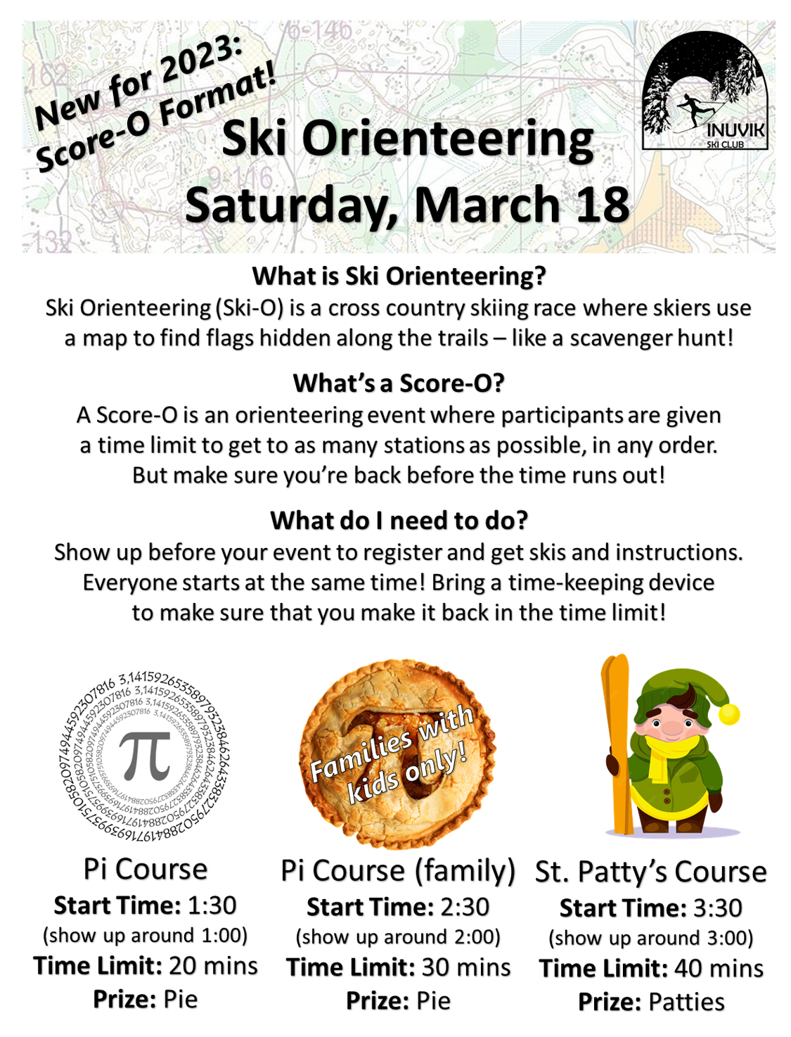
Ski-O Score-O 2023 (March 18, 2023)
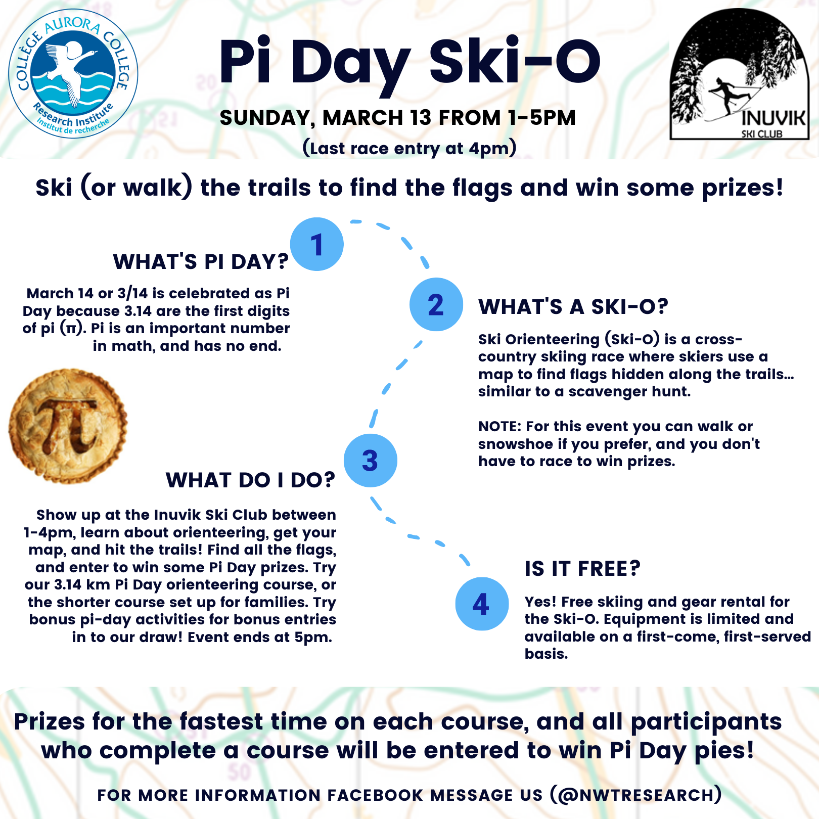
Pi Day Ski-O 2022 (March 13, 2022)
Pi Day Ski-O 2021 (March 14, 2021)

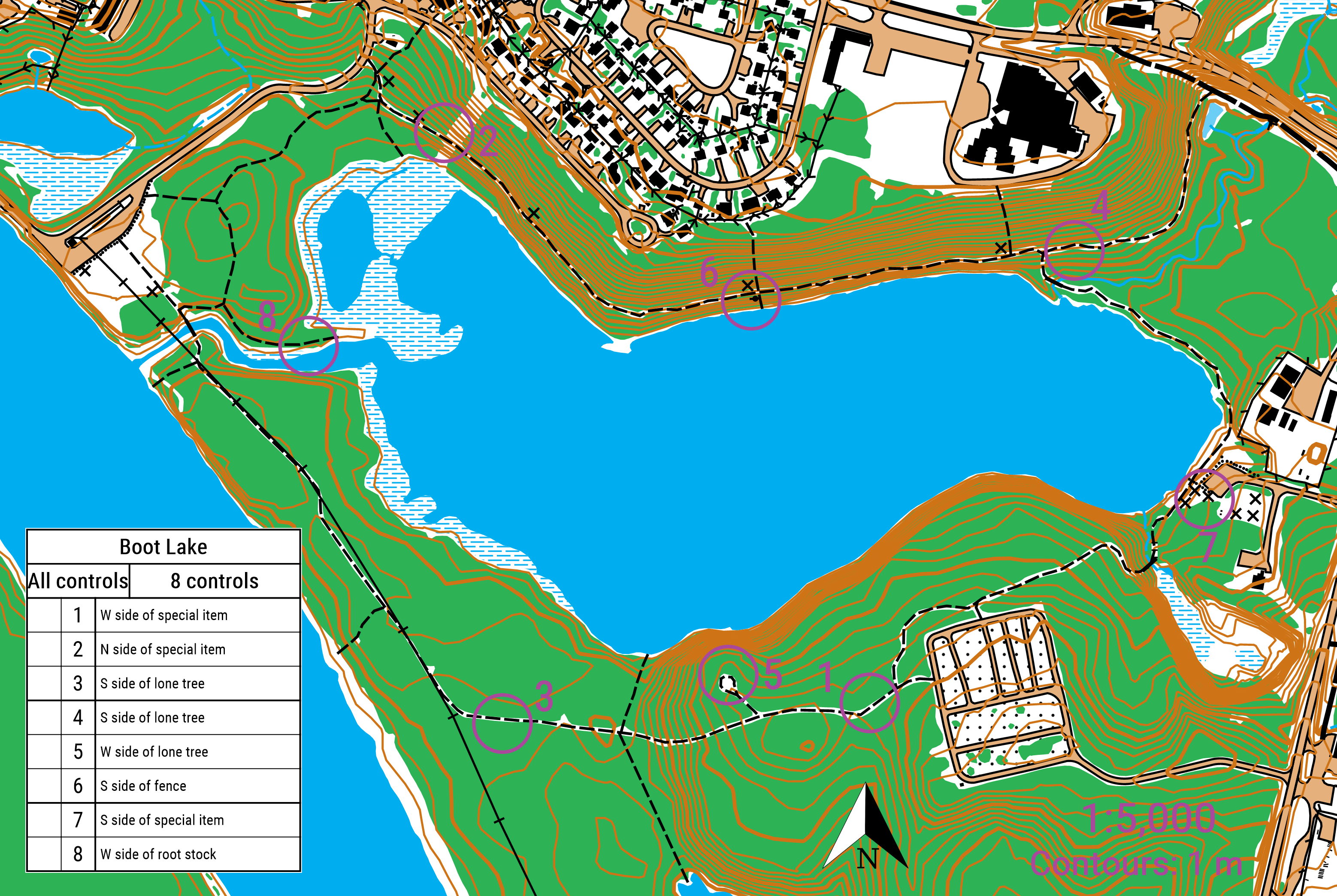
Boot Lake Orienteering Challenge (May 2020)
- Download the course map as a PDF or as an image file
- Either print the map, or save it on the device you'll take with you.
- Here is a legend that explains what the symbols on the map mean.
- The purple circles on the map show you were the “controls” are hidden. Controls are orange and white orienteering flags. Each one has a letter on it. They look like this:

- Don't take the controls! Leave them for others to find, just jot down the letter from each one.
- Find each of the controls to reveal a secret message. You can find them in any order, but the numbers on the map show you the order that spells out the message.
- You don't need a compass for this course, but if you have one, bring it along!

Additional information
- If you're sure that you're in the right spot and the flag is missing, contact Faye.
- Normally orienteering uses big hanging flags so they're easy to see. I made little 3×3“ squares and stuck them to the backs of trees and such so that people wouldn't take them down. So there's definitely more of a “scavenger hunt” element than normal orienteering.
- For runners: orienteering is normally a running/map-reading race that has to be done in a specific order. So, if you want an extra running challenge, start and end at the trailhead signpost and hit up the stations in the given order. The route is 5.3 km as the crow flies. Hard mode runners' map.
Media

Setting Your Own Orienteering Course
You can download the current 1:5000 scale basemaps for Boot Lake, Twin Lakes, or the Ski Trail areas. Contact Faye if you would like the omap files.